
價格:免費
更新日期:2019-06-25
檔案大小:95.3 MB
目前版本:4.0.4
版本需求:需要 iOS 11.0 或以上版本。與 iPhone、iPad 及 iPod touch 相容。
支援語言:英語

Map Pilot helps you create and fly the optimal flight path to create great maps using the Maps Made Easy map processing service. Collecting great data to create high resolution aerial maps with your DJI flying camera is just a few clicks away. Process into the final product using your own photogrammetry software or our Maps Made Easy online service. Mapping has never been easier.
Process unlimited jobs of up to 104 images (12 megapixels) for free with Maps Made Easy.
Get Map Pilot Business instead of this app to get all of the In App Purchases included by default and save money in the long run.
View Full Documentation: http://support.dronesmadeeasy.com
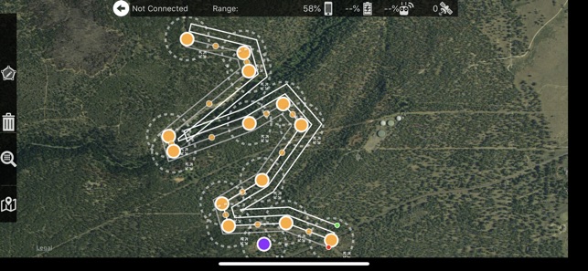
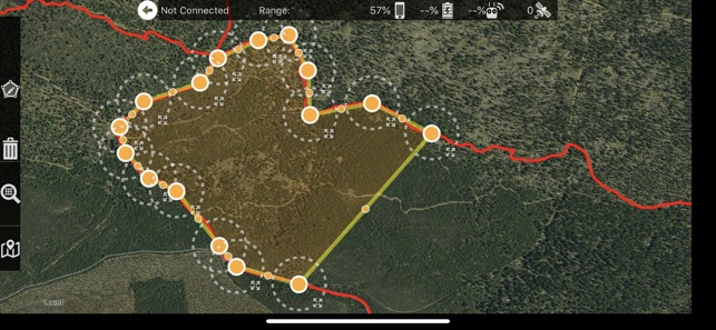
Define the area, select the level of detail, and go.
Features:
Multi-Battery Management
Manual Restart Point Selection
Automatic, Shutter Priority and Manual Exposure Modes
Basemap Caching for Offline Operations
Connectionless Camera Triggering
External Map Data and Markers via MapBox
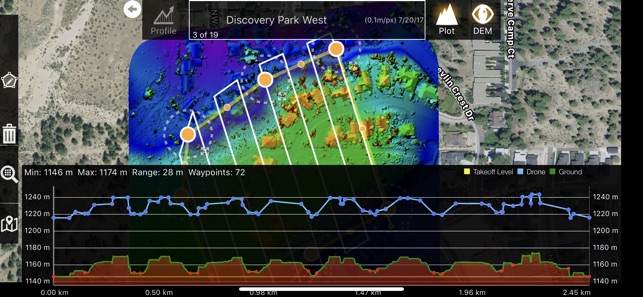
Terrain Aware Image Footprint Display
Fully Offline Capable Terrain Awareness (IAP)
Multi-Pass Linear Mission Planning (IAP)
Custom Terrain Data Import
3D Grid Mission Planning
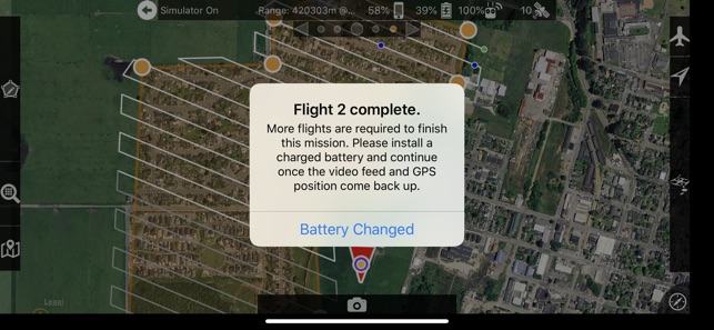
Multi-Flight Coordination
Movable Home Point to Track the Pilot (IAP)
Save/Edit Missions
Refly Saved Missions
View 3D logs on-device with Google Earth
Import KML via Email or AirDrop
Export KML, log files, and Flights file via Email or AirDrop
Flight Log review
Built-in Simulator for testing
HealthyDrones upload from Log File Manager
RAW imaging available via In App Purchase
Fullest Possible Use of Each Battery
Appropriate Camera Triggering
Overlap Management
Speed Management
Automatic Takeoff and Landing
Live Video Preview (large and small)
Signal Quality Warning
Line of Sight Indicator
Automatically Captures Elevation Reference Image (Ground Image)
Natural Landing Assistance
Live Map View
Compatible with iOS 11 and iOS 12.
Supported Aircraft:
See our site for the full list - https://support.dronesmadeeasy.com/hc/en-us/articles/205704366-Supported-Hardware
Mavic Pro
Mavic Air
Mavic 2 (Pro, Zoom, and Enterprise)
Phantom 4
Phantom 4 Pro * (v2 included)
Phantom 4 Advanced
Phantom 3 Professional
Phantom 3 Advanced
Phantom 3 Standard

Inspire 1
Inspire 1 Pro
Inspire 2
Matrice 100 (M100)
Matrice 200 (M200)
Matrice 210 (M210)
Matrice 210 RTK (M210RTK)
Matrice 600 (M600)
Matrice 600P (M600P)
Supported External Cameras:
DJI X3
DJI X5
DJI X4S
DJI X5S
Sony a7R, a7R II, and a7R III only with Drones Made Easy trigger board*
Sony A6000 only with Drones Made Easy trigger board*
Sony Multispectral Camera (MSZ-2100G) as part of the Drones Made Easy and Sony Smart Agriculture Solution
* Matrice 200/210/600/600P with Sony a7R and other custom camera sensors will require a Drones Made Easy custom trigger board that will only be sold as fully integrated kits built by Drones Made Easy. Email for more details.
* Phantom 4 Pro v2 is supported. Phantom 4 Pro Plus version is not supported.
No Ronin support is available.
支援平台:iPhone, iPad